Case study · Property investment
Finding abandoned buildings
in Lisbon,
street by street.
An overseas property investment fund asked me to explore a question: could an AI agent search Lisbon for abandoned buildings, then help work out how to investigate the findings?
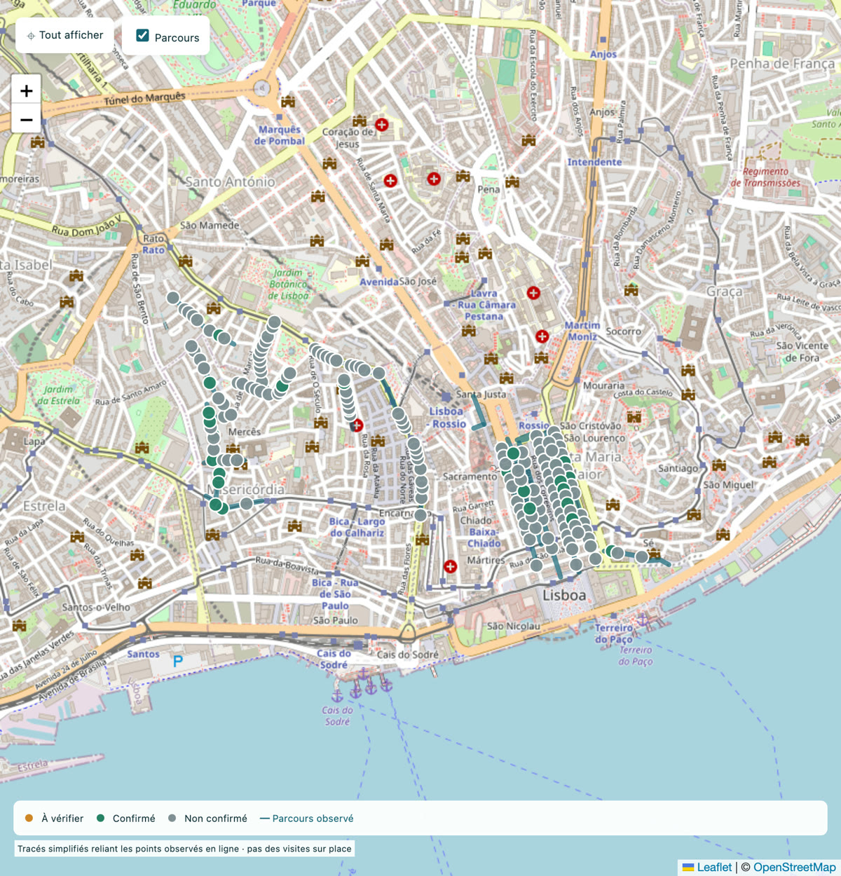
Key: À vérifier = pending review · Confirmé = confirmed · Non confirmé = not confirmed · Parcours observé = route surveyed.
The
challenge.
The fund wants to buy abandoned buildings and renovate them. They can be found across Lisbon’s older neighbourhoods, but there is no reliable list. City records describe the buildings, not their condition, and existing reports are dated.
That means looking street by street. Lisbon has more than 2,200 streets. At one street a day, the survey would take more than six years.
Could an agent do that first survey, and leave a useful starting point for the next stage?
How
it works.
Cover both sides of each street
The agent works through streets in the older central and western neighbourhoods. It identifies each end of a street, moves between closely spaced viewpoints and inspects both sides, including the upper floors.
Check when the images were taken
Street View sometimes shows an older image even when a newer one is available. The agent selects the most recent view and notes any stretch without recent coverage.
Flag signs of neglect
A vision model reviews the images in batches and flags possible signs of neglect: bricked-up openings, broken or missing glass, badly damaged plaster, vegetation and open roofs. A blurred or obstructed view is marked as impossible to inspect, never as having nothing to report.
Review uncertain results
A second pass at full resolution reviews every uncertain result, along with one in ten rejected images. If that check finds a missed building front, the whole street is reviewed again.
Keep a map for human review
Each flagged building front appears on a map with its image, date and Street View link. I confirm or dismiss it and record the reason.
The
results.
- 157
- streets fully surveyed, on both sides
- 573
- building fronts flagged
- 731
- dated photos, each linked to its street
The survey records visible signs, not proof that a building is vacant. A neglected building may still be occupied, and an image may be several years old. Every marker keeps its dated photo so the finding can be checked again.
What
comes next?
A flagged building front is only a lead. The next step is to identify the property in the city’s records, then find its exact land registry reference. An official extract costs a few euros. That reference provides the basis for making contact through the appropriate channels.
What you
could build.
The same approach can help with your own work: ask an agent to survey an area, a catalogue or thousands of documents, with clear rules and a record of each decision. A person reviews the findings before they are used.
This is the kind of tool we can build together in our sessions, using a task from your business. You do the building, with me there to guide you.
Let’s talk about your business
What’s taking up too much time?
Tell me what keeps slowing you down. We’ll look for a practical starting point, whether that’s less admin, better follow-up with prospects or a smoother service for your customers.
Book a call to get started